In this article I want to talk about geolocating something from photos taken at night time, especially if the image or video is of poor quality. For those more familiar with the game GeoGuessr, depending on where you’re dumped on the map, it’s like trying to find where you are in a pitch black maze with very little reference points. Let me unpack some things first.
What is geolocation Open Source Intelligence?
It’s the use of maps, images, video, and other publicly available sources to find the location of a person, place, or thing. The publicly available sources and information is the Open Source Intelligence (OSINT) part. OSINT, aside from collecting information in the public domain, is the analysis and use of what you gathered.
Geolocation is part of an intelligence discipline called Geo-spatial Intelligence or GEOINT. This is gaining intelligence through Geo-spatial data to see human activity on earth. Some of the sources like satellite imagery and GPS data may be closed source therefore not part of the OSINT domain.
When it comes to geolocation OSINT, the name of the game is finding points of reference, verifying them, and using that information to figure out the location of your target.
Depending where you are looking and the source material you’re using, it may be fairly easy or incredibly difficult. An image or video you’re working with may have many reference points to use. You might run into this when what you’re looking for is in an urban, more densely populated area, or something that’s very unique to the landscape. Where things get tough is where there is very little information to go on in the source material.
The bare minimum you’ll need to do some geolocating is a map and search engines.
If you’d like to give it a go yourself, check out one of our OSINT challenges on Facebook https://www.facebook.com/bsquaredintel/videos/937035757085581
Geolocating in the dark
Geolocating something in an image or video that was taken in the evening presents its own challenges. I was looking into something whose source was a very low quality image shot at night. There was very little to go on. What it boiled down to was attempting to match shapes to where I suspected the event happened. There were no points of reference regarding landscape or surrounding buildings. This is the challenge of doing something in rural area.
A positive side of geolocating something in the dark may come from a densely populated area where there’s a lot of signage that’s lit up making things easier to identify.
What I want to do next is to show you how to work through something similar I ran into.
Example
For this example, my goal was to figure out where the car was in this YouTube video https://www.youtube.com/watch?v=K0XGC0INkco from the channel Yung Shade Dash Cam
Here’s a thumbnail from the video.
There’s not much you can really make out, which is similar to the incident I was researching. In my case, I didn’t have a video to go on, but I did know a very broad geographic location.
With this video, I, and you, don’t have that helpful bit of information. So, how do we go about solving this?
First watch the video and then analyze it. Make note of things that stick out to you that you think are helpful key elements.
Some key moments in the video:
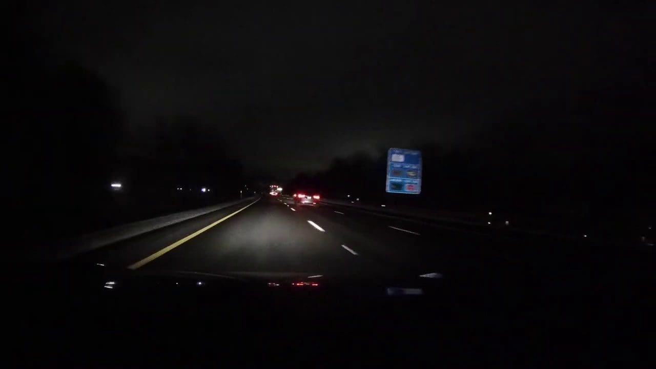
- At the 1 minute 47 second mark, while watching the video you can make out what looks like Interstates I-290 or I-295 on a sign to the right of the highway.
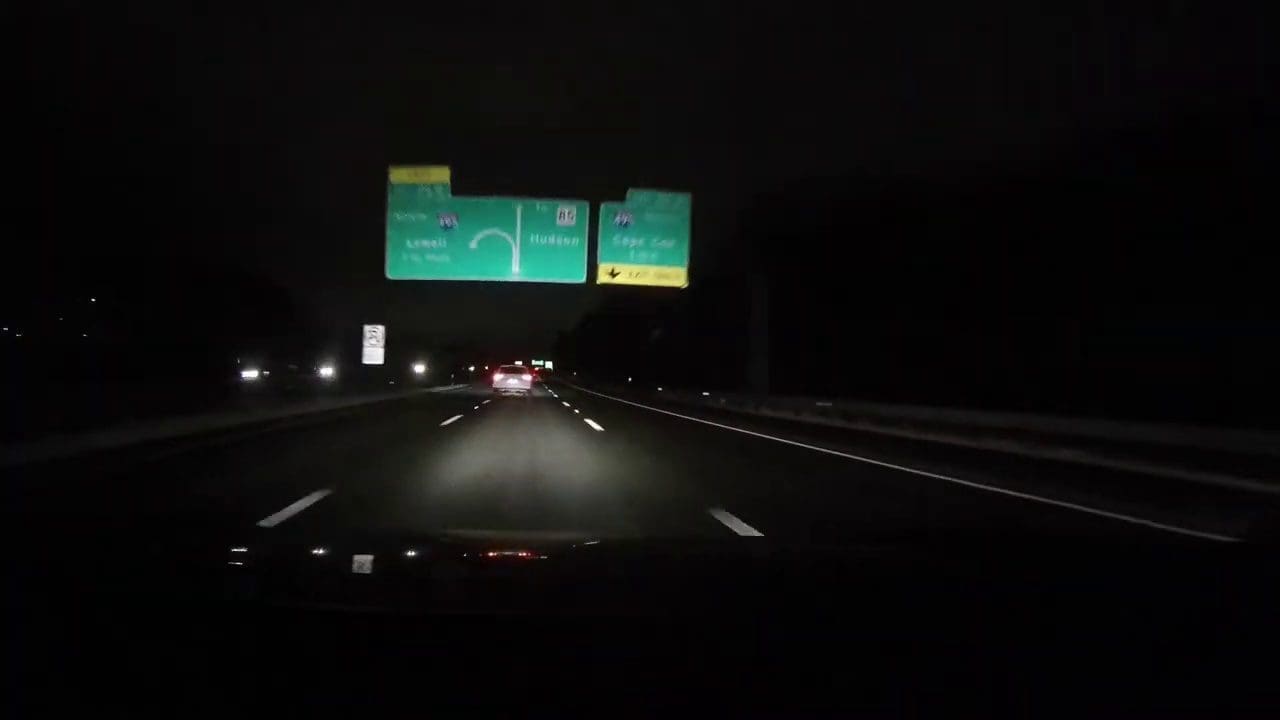
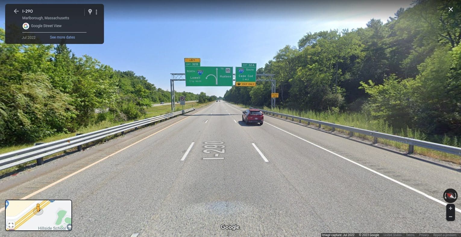
- At the 2 minute 15 second mark we see at the overpass sign what looks like Interstate I-495, route 85, and we have some names we can discern: Lowell, Cape Cod, and Hudson. See screenshot below.
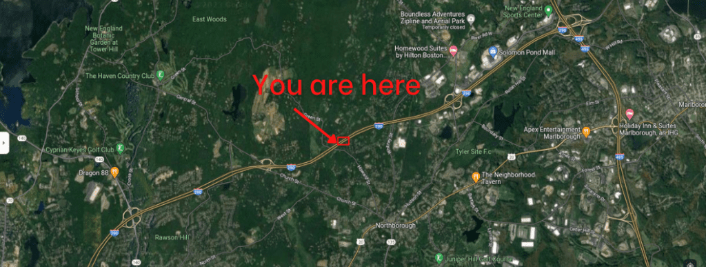
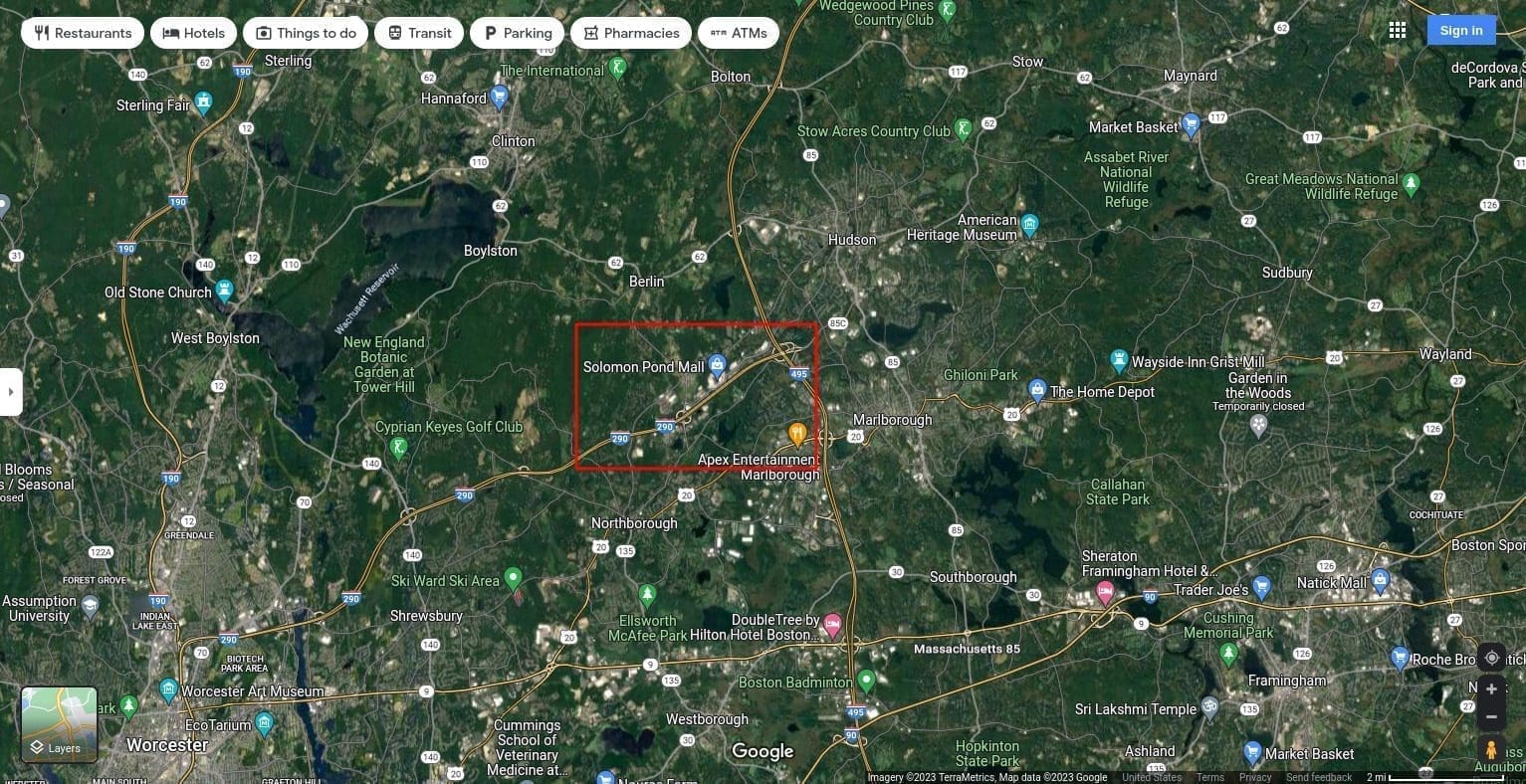
If we fire up Google Maps and enter these route numbers and names to look up, we know at a minimum that we are somewhere in Massachusetts.
Next, we want to find where I-495 in relation to Lowell MA is, where Hudson MA and route 85 are, and where I-495 in relation to Cape Cod MA is. Then we want to see if I-295 or I-290 fits the highway the person is driving on.
In the screenshot below we can see that I-290 fits our description as it’s running into I-495 and we also see that the town of Hudson is nearby, as well as Route 85.
The next step is to find this overpass sign from the video on Google Maps and then to confirm it by using Google Streetview. Voici!
Also here are the night and day images side by side.

If we want to see approximately where the person is at the start of the video, we now have an anchor reference point to use. This is “home base” if we get lost or need to look around to see what is nearby that can give us clues. It’s now just a matter of going in the opposite direction in Google Street view.
Another stand out reference point in the video, now going backwards in time, are the double warning signs at the 43 second mark.

Here’s the side by side comparison.

I think for clarity, what I’ll do is make this the featured topic in a near future weekly roundup video because, like anything relating to OSINT, there is no linear process to figure something out and it might be easier to visualize the process in a video.
How does this fit into what Bsquared Intel is about?
Being able use geolocation OSINT may help an organization figure out a threat targeting their company. This can be added on to our External Risk/Threat assessment offering or as a standalone service.
Attorneys may find this useful if their case has geolocation OSINT needs.
Need Bsquared Intel’s help? Use the contact form below and while you are here, sign up for our free newsletter https://bsquaredintel.com/newsletter-signup/
Contact Us | Bsquared Intel
Please fill out the form below, or call 203.828.0012, to learn how bsquared intel can assist you.